SIMPLE
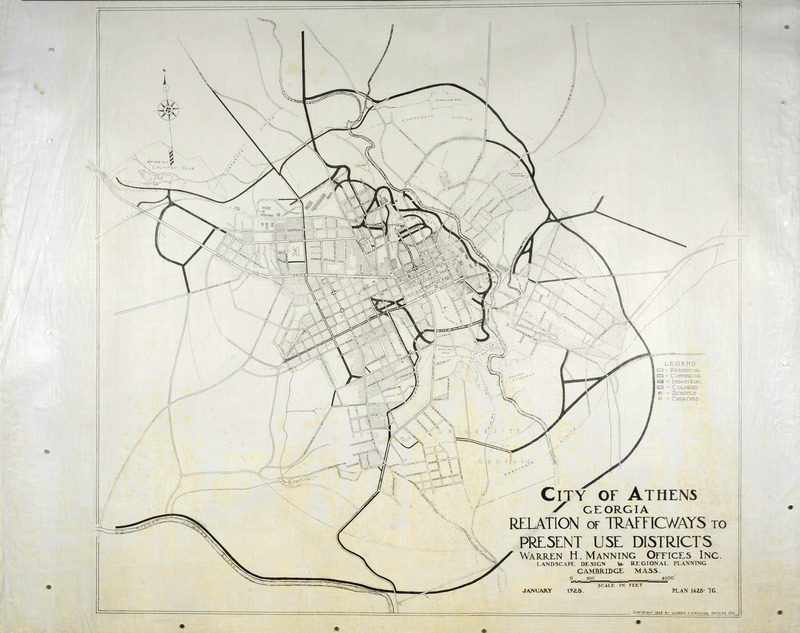
Street map, Athens, Georgia, 1925 Item Info
- Title:
- Street map, Athens, Georgia, 1925
- Date Created:
- 1925-01
- Time Period:
- 1920s
- Description:
- Street map, Athens, Georgia showing the relation of trafficways to present use districts, January 1925. Ink on tracing cloth. Dimensions: 36 x 43 in.. Scale 1" = 800'. Project number: 1428
- Subject (Topic):
- Landscape architecture Landscape architecture--Designs and plans Landscape architectural projects City planning
- Location:
- Georgia--Athens
- Language:
- zxx
- Source:
- Warren H. Manning papers
- Call Number:
- MS 218
- Finding Aid Permalink:
- https://n2t.net/ark:/87292/w9z76p
- Contributing Institution:
- Iowa State University. Special Collections and University Archives
- Publisher:
- Iowa State University. Library
- Extent:
- 1 Map; 36 x 43 in.
- Genre:
- maps (documents) cartographic materials
- Type:
- Image
- Format:
- image/jpeg
- Digital Collection Title:
- Warren H. Manning collection
- Digital Collection Permalink:
- https://n2t.net/ark:/87292/w92804z4t
- Identifier:
- manningwarren7689
- Filename:
- 0218_manning_1428-076.jpg
- Item Permalink:
- https://n2t.net/ark:/87292/w99351
Source
- Preferred Citation:
- "Street map, Athens, Georgia, 1925", Warren H. Manning Collection, Iowa State University Library Digital Collections
- Reference Link:
- https://n2t.net/ark:/87292/w99351
Rights
- Rights:
- The Iowa State University Library believes that this item is in the public domain under the laws of the United States, but a determination was not made as to its copyright status under the copyright laws of other countries. The item may not be in the public domain under the laws of other countries.
- Standardized Rights:

