
COMPLEX
Map of campus and grounds, Iowa State College Item Info
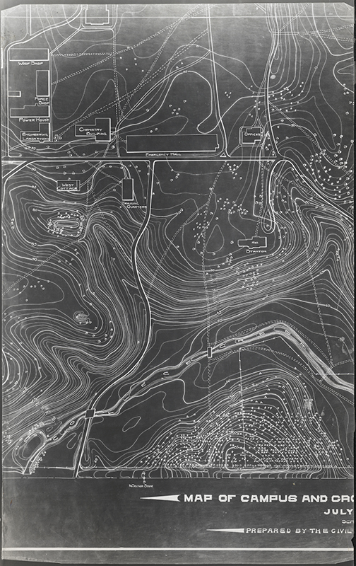
- Title:
- Map of campus and grounds, Iowa State College
- Date Created:
- 1903-07
- Time Period:
- 1900s
- Description:
- Topographic maps of the Iowa State College campus prepared by the Civil Engineering Department.
- Subject (Topic):
- College campuses Contours (Cartography)
- Subject (Organization):
- Iowa State College
- Location:
- Iowa--Ames
- Latitude:
- 42.03471
- Longitude:
- -93.61994
- Language:
- zxx; eng
- Source:
- Campus Maps, 1868-2008
- Call Number:
- RS 4/8/0/7
- Folder Title:
- Campus Maps, 1875-1914, undated
- Finding Aid Permalink:
- https://n2t.net/ark:/87292/w90p0wv24
- Contributing Institution:
- Iowa State University. Special Collections and University Archives
- Publisher:
- Iowa State University. Library
- Extent:
- 8 map panels
- Genre:
- maps (documents)
- Type:
- Image Text
- Format:
- image/jpeg
- Digital Collection Title:
- Iowa State University historical maps
- Digital Collection Permalink:
- https://n2t.net/ark:/87292/w96w96851
- Related Resource:
- Campus Cornerstones
- Identifier:
- historicalmaps34
- Item Permalink:
- https://n2t.net/ark:/87292/w9fj29m0d
The Iowa State University Library is committed to creating a welcoming digital environment for all learners. Certain material, particularly older materials, handwritten documents, and visual content, present unique challenges in providing more accessible resources. Please contact us if you need support accessing or using this archived content.
Contact us about this recordSource
- Preferred Citation:
- "Map of campus and grounds, Iowa State College", Iowa State University Historical Maps, Iowa State University Library Digital Collections
- Reference Link:
- https://n2t.net/ark:/87292/w9fj29m0d
Rights
- Rights:
- The Iowa State University Library believes that this item is in the public domain under the laws of the United States, but a determination was not made as to its copyright status under the copyright laws of other countries. The item may not be in the public domain under the laws of other countries.
- Standardized Rights: