
SIMPLE
Map of Iowa State College, Ames, Iowa Item Info
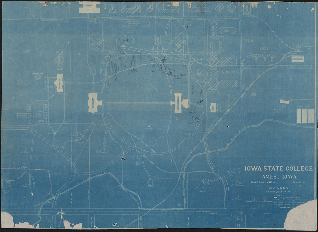
- Title:
- Map of Iowa State College, Ames, Iowa
- Creator (Person):
- Irish, H. C. (Henry Clay), 1868-1960
- Date Created:
- 1914-02
- Time Period:
- 1910s
- Description:
- Map of the Iowa State College campus prepared by H.C. Irish, landscape architect. The map has landscaping notes written on it.
- Subject (Topic):
- College campuses Landscape architecture
- Subject (Organization):
- Iowa State College
- Location:
- Iowa--Ames
- Latitude:
- 42.03471
- Longitude:
- -93.61994
- Language:
- zxx; eng
- Source:
- Campus Maps, 1868-2008
- Call Number:
- RS 4/8/0/7
- Folder Title:
- Campus Maps, 1875-1914, undated
- Finding Aid Permalink:
- https://n2t.net/ark:/87292/w90p0wv24
- Contributing Institution:
- Iowa State University. Special Collections and University Archives
- Publisher:
- Iowa State University. Library
- Extent:
- 1 map
- Genre:
- maps (documents)
- Type:
- Image Text
- Format:
- image/jpeg
- Conservation for Digitization:
- Tape removal, paper repair
- Digital Collection Title:
- Iowa State University historical maps
- Digital Collection Permalink:
- https://n2t.net/ark:/87292/w96w96851
- Related Resource:
- Campus Cornerstones
- Identifier:
- historicalmaps33
- Filename:
- cornerstones105.jpg
- Item Permalink:
- https://n2t.net/ark:/87292/w9k64b117
The Iowa State University Library is committed to creating a welcoming digital environment for all learners. Certain material, particularly older materials, handwritten documents, and visual content, present unique challenges in providing more accessible resources. Please contact us if you need support accessing or using this archived content.
Contact us about this recordSource
- Preferred Citation:
- "Map of Iowa State College, Ames, Iowa", Iowa State University Historical Maps, Iowa State University Library Digital Collections
- Reference Link:
- https://n2t.net/ark:/87292/w9k64b117
Rights
- Rights:
- The Iowa State University Library believes that this item is in the public domain under the laws of the United States, but a determination was not made as to its copyright status under the copyright laws of other countries. The item may not be in the public domain under the laws of other countries.
- Standardized Rights: